at a certain point
Unsere Welt ist auf Effektivität und schnelle Interaktionen ausgelegt. Herumwandern ist fast komplett aus unserem Alltag verschwunden. Der Weg ist nicht mehr das Ziel. Das Ankommen ist das Ziel. Aber was passiert, wenn man kein festes Ziel hat? Fängt man überhaupt an, zu laufen?
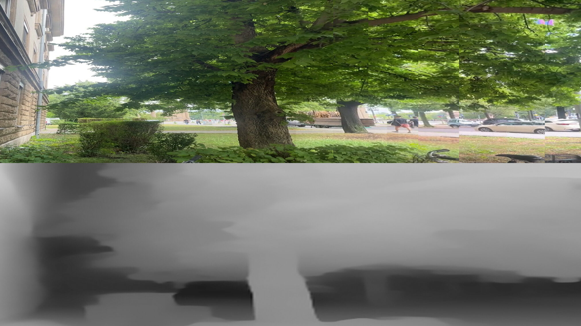
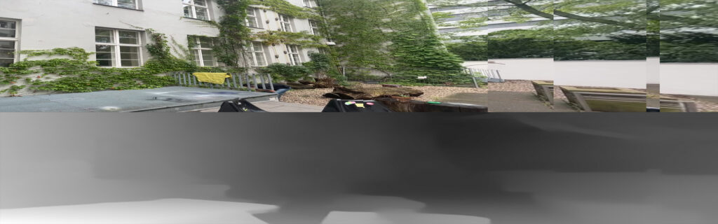
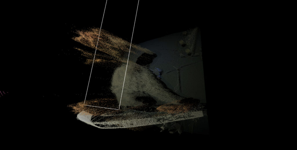
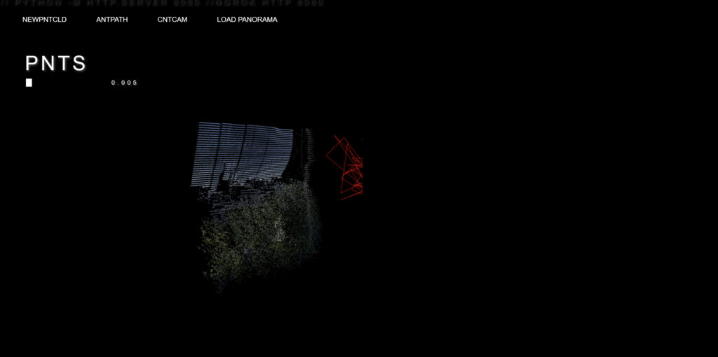
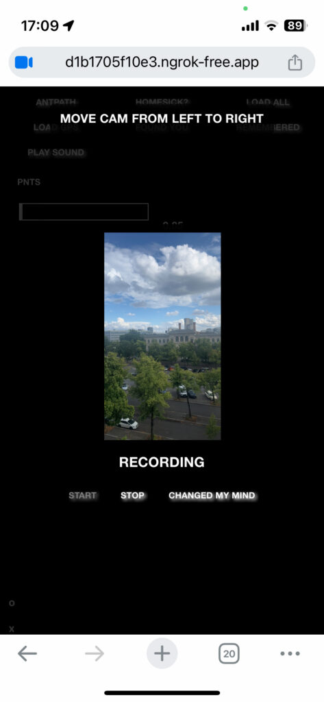
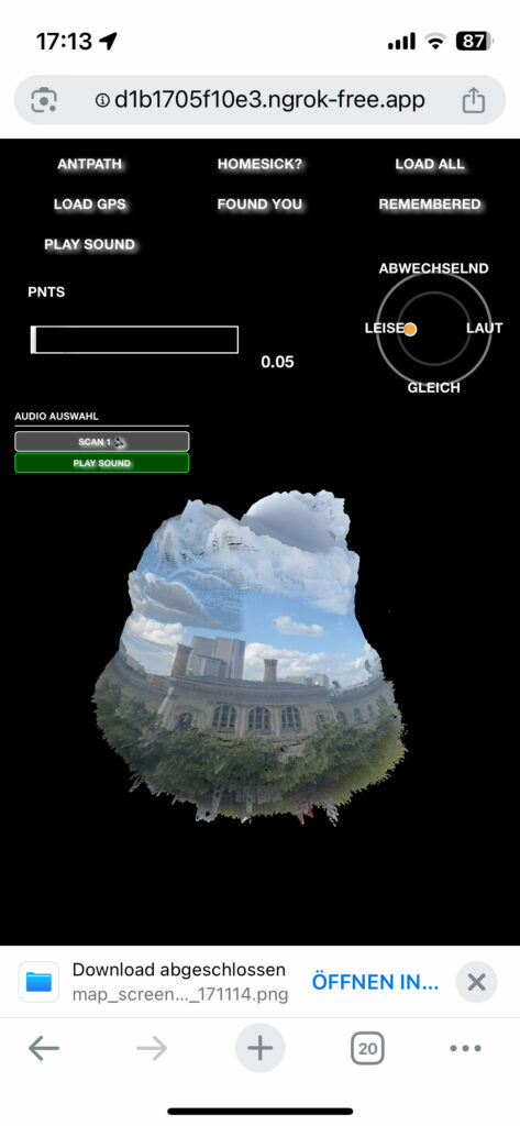
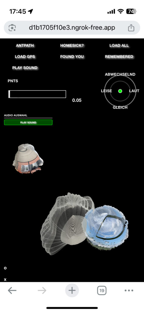
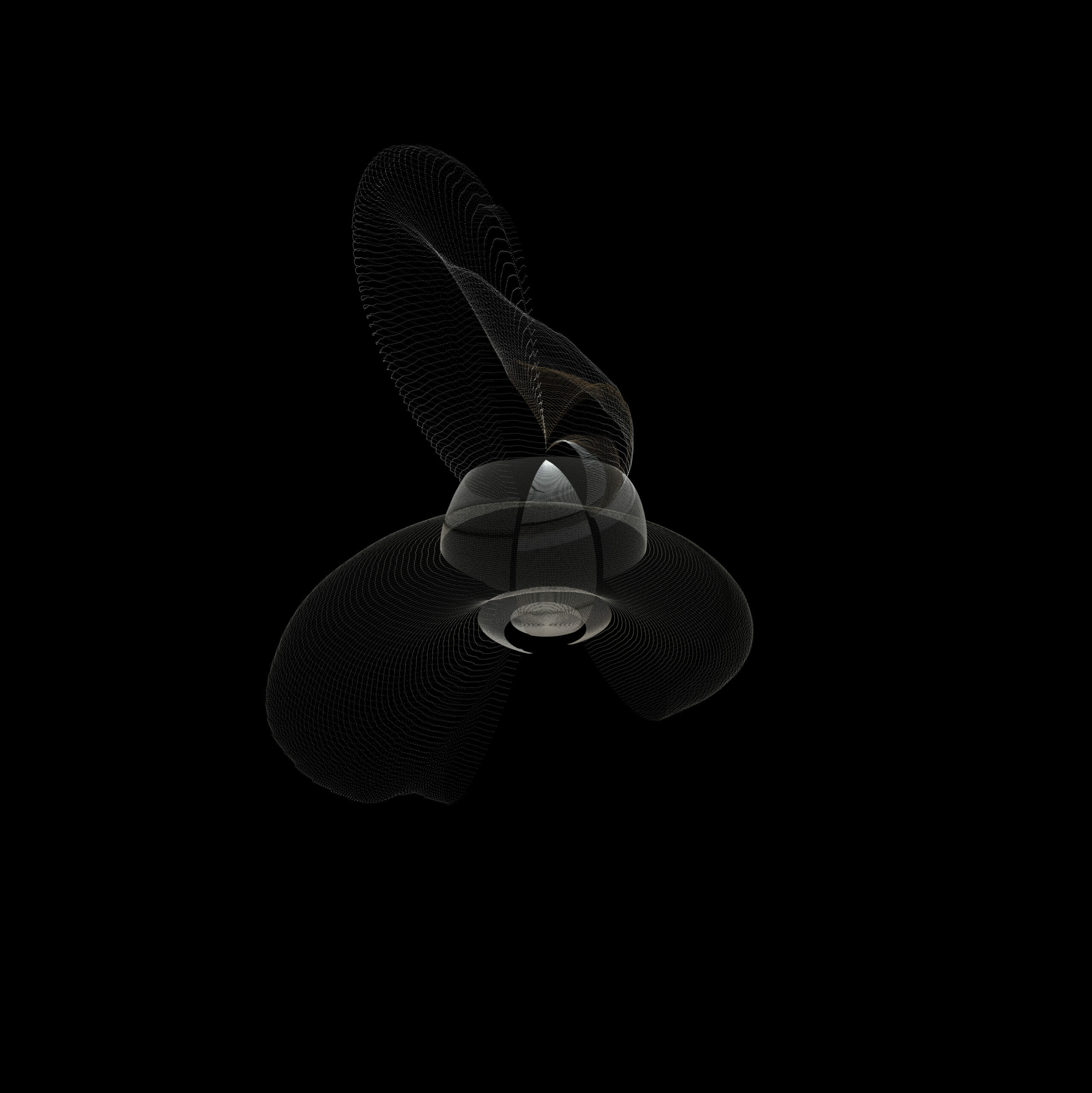
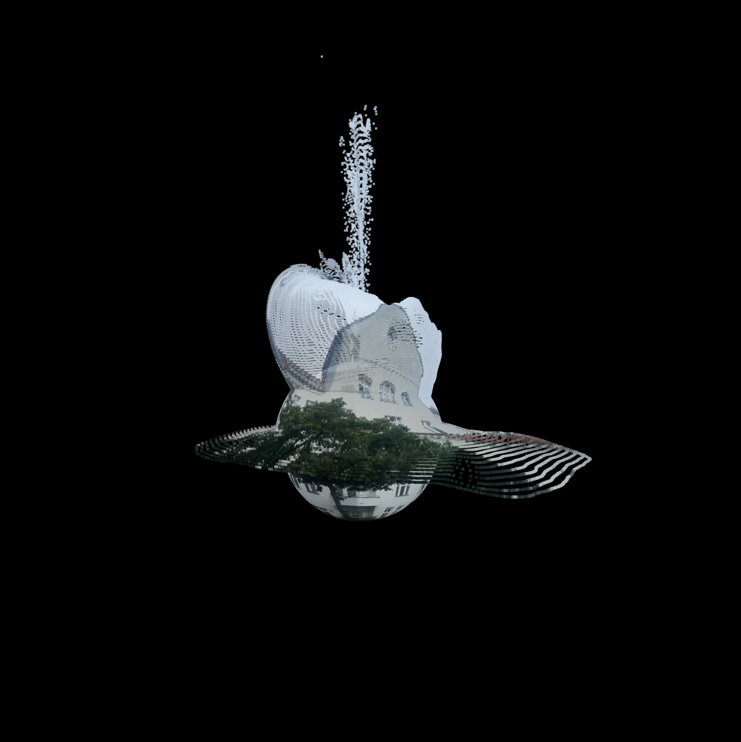
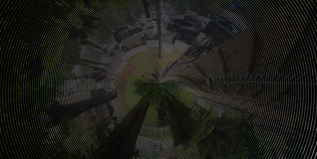
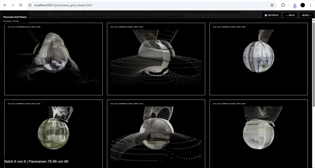
Das Projekt ‚an einem bestimmten Punkt‘ ist eine Webbrowser Applikation, die ermöglicht, eine individuelle Karte mithilfe alternativer Daten zu erstellen. Ein aufgenommenes Panoramabild wird in eine Point Cloud umgewandelt und in der digitalen Karte eingefügt. Wenn die äußeren Umstände während der Aufnahme dazu führen, dass das Panorama verwackelt oder unscharf wird, wird das auch auf dem eingefügten Scan sichtbar sein. Zudem beeinflusst die während der Aufnahme existente Geräuschkulisse die Darstellung des Scans.
Für Außenstehenden wird es dadurch schwierig, die dargestellten Orte in den Scans zu erkennen. Nur die Person die die Scans erstellt hat, kann sich an den eingescannten Moment erinnern und somit den Scan decodieren. Die erstellten Point Clouds sollen als Gedächtnisstützen für Momente dienen. Das Projekt soll ermutigen seine Umwelt mit allen Sinnen wahrzunehmen und wieder mehr Wertschätzung für diese zu bilden.
Als Inspiration für mein Projekt dienten die Sonic Meditations von Pauline Oliveros und die Kunst der kritischen Kartografie. Ich habe mich mit Fragen beschäftigt wie: wer entscheidet was kartografiert wird? Für welche Zwecke erstellen und benutzen wir Karten? Welche Daten werden in visualisiert. Was für Schlüsse über unsere Gesellschaft können wir daraus ziehen?
Das Projekt wurde mit Hilfe von KI programmiert.
Our world is layed out for effective and fast interactions. Strolling around has become almost obsolete in our day to day life. We are focused on arriving somewhere instead of going to places. But what if you dont have a desired destination? Will you even start walking?
The Project ‚at a certain point‘ is a Webbrowser application that invites you to built your own map based on alternative data. User capture their enviroment with a Panorama Picture that gets transferred into a Point Cloud and placed at the users current GPS Location in a map. If your enviroment causes your Panorama to look shaky or blurry the scan in the map will do too. The Sound of the moment of recording alters the scans appearance too.
Others may not recognize whats being displayed on the scan. Just the Person who scanned the moment can remember and decode the Point Cloud. The Point Clouds should function as a marker for a moment. The Project should encourage users to experience their surroundings with all their senses to gain more appreciation for it.
Inspirations for this project were Paulina Oliveros Sonic Meditations and the art of critical cartography. I refelcted on questions like: who decides what is getting mapped? For which Purpose are maps made? Which data is being shown in maps? What conclusions about our Society can we draw from the answers to these questions?
the Project was coded with the help of AI.
THE PROJECT
THE PROCESS